Summary
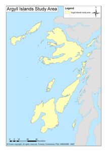 Background
Woodland on the Argyll Islands consists of:
- Conifer forests, often occur as large, angular blocks on lower and mid-slopes
- Mixed woodland occurring locally, usually as policy woodlands on favoured sites at low elevations around large houses
- Native broadleaved woodland located in loosely defined groups or isolated woods. These broadleaved woodlands are mainly along the coastal zone and in gullies leading inland from coasts and at low elevations (below 250 m) on hill slopes.
Ravines are important for providing sheltered conditions which allow woodland to flourish despite the climate. The oceanic climate and the wide range of soil types result in a great diversity of native woodland types and often in rich assemblages of oceanic woodland ferns and lower plants.
Woodland is also restricted by the presence of mires and other wet soils which, combined with the wet and windy climate, effectively preclude tree growth. Exposure, poor soils and sometimes past management practices combine on some islands to give extensive areas without trees. On some islands agricultural activity is widespread, and tree cover is restricted because of this.
Objectives
This project provides information about native woodland expansion and restoration opportunities on the Argyll Islands to:
- Improve the connectivity of native woodlands
- Avoid damaging non-wooded habitats and land uses
- Target land most suitable for woodland establishment.
Methods
The network analysis for the Argyll Islands required:
- A detailed analysis of native broadleaved woodland by incorporating a woodland quality assessment.
- Determination of networks for high biodiversity quality woodlands within broadleaved networks and the wider woodland resource.
- Identification of opportunities for improvement, conversion, and expansion of woodlands to reduce native broadleaved woodland fragmentation.
- Determination of areas where woodland expansion is not suitable, i.e. priority open ground habitat, designated areas, high winds.
Results
Forest Habitat Networks in the Argyll Islands (PDF-203K)
The functional connectivity of existing networks indicated opportunities for their improvement, expansion, or linkage, and where to gain landscape-scale biodiversity benefit from converting coniferous stands to native broadleaved woodland:
Opportunities include:
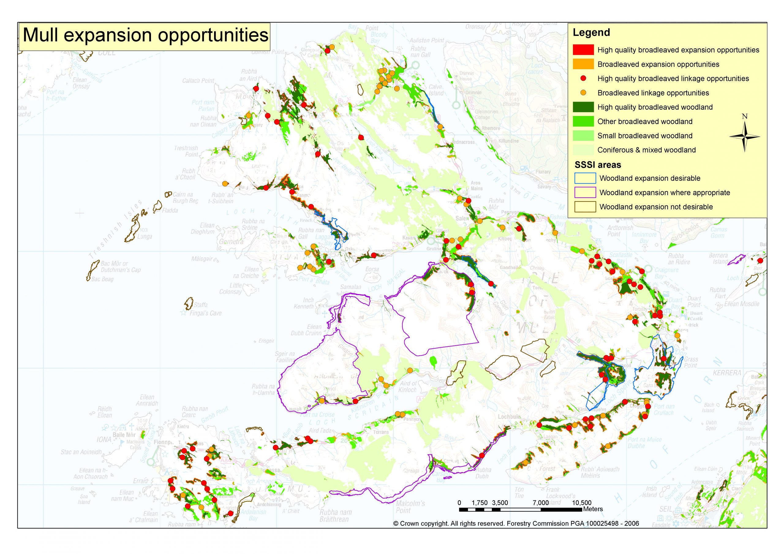
Map A
- Protect and expand existing high biodiversity woodland by natural regeneration or planting on appropriate open ground (Map A).
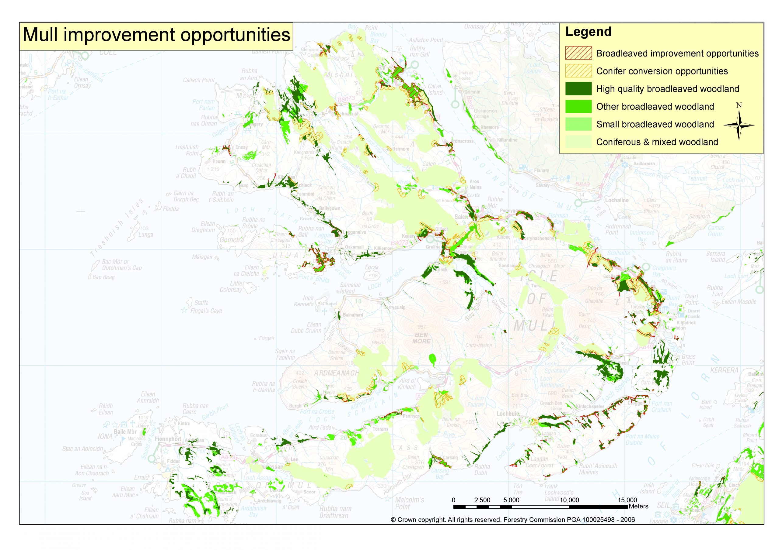
Map B
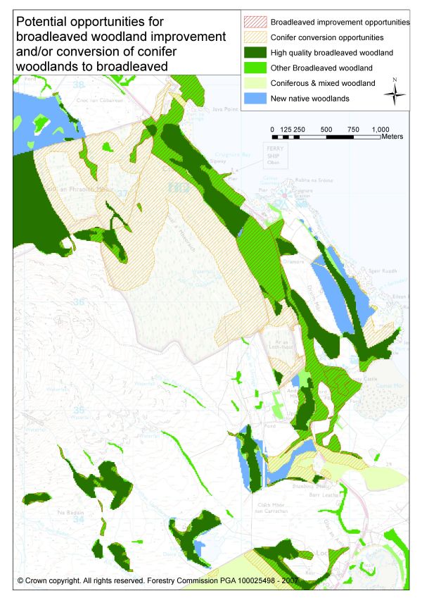
- Improve the biodiversity quality of woodlands adjacent to high quality woodland to form larger networks of high biodiversity quality woodland by targeted management (Map B).
- Expand broadleaved woodland to link neighbouring woodland patches into a network across the zone extending up to 500 m from the edge of each patch. This represents the area and limit of new woodland establishment by regeneration (the first 50 to 100 m) and planting (beyond 50 to 100 m) (Map A).
- Restore and convert conifer stands to native woodland, where conifers separate patches of broadleaved woodland. This will reduce the isolation of broadleaved woodland and, over time, link patches of woodland within larger networks (Map B).
- Link neighbouring networks by planting new “stepping stone” woodland between patches within existing networks to allow dispersal through the matrix and the new woodland patch (Map A).
This approach considered the importance of open ground habitats and ensured the targeting of land most suitable for woodland establishment. Land considered unsuitable for woodland and excluded from expansion and linkage opportunities included areas of high wind exposure, peat bog, and sites designated for conservation (e.g. wetland, geological, and aquatic habitats).