Summary

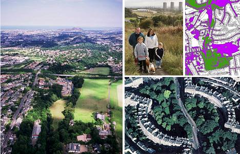
(Aerial photo left: Patricia & Angus MacDonald/Aerographica)
Background
The concept of green space (for example see – www.greenspacescotland.org.uk), or urban greening, has received considerable attention. It is seen as a means of attracting people into their local natural environment by improving community access, recreation opportunities and environmental and ecological quality close to, and within, communities.
The development of habitat networks is widely seen as a key mechanism for reversing the effects of fragmentation on biodiversity while delivering a range of other social and environmental benefits such as enhancement of local landscape character and greater opportunities for public access and recreational use.
This research, under the Scotland and Northern Ireland Forum For Environmental Research (SNIFFER) Urban Environment programme, aims to clarify and propose a direction for the implementation of networks in urban environments.
Objectives
The project objectives are to:
- Review recent approaches for the identification and analysis of habitat networks and examine opportunities to apply these to urban areas
- Explore methods for identifying and assessing the value of green networks for people
- Identify relevant social, and environmental datasets that could be linked to green network data to investigate the potential for planning green networks with multiple functions
- Recommend a methodological approach for the mapping and analysis of multi-functional green networks, highlighting any critical data or knowledge gaps.
Methods
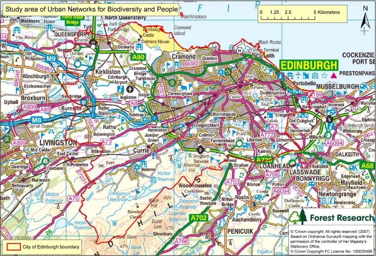
Edinburgh study area:

Identification of the biodiversity networks was undertaken through:
- Classifying each land cover type into one of 5 biodiversity categories (high to low) for greenspace and other land cover
- Employing least-cost modelling using a GIS to represent the functional connectivity of each network.
Determination of the social networks was undertaken through:
- Representing how people are attracted to greenspace i.e. the ‘pull’ of greenspace
- Mapping and categorising access routes and access points to greenspace according to safety and attractiveness of routes
- Constructing three user profiles to describe people’s likelihood or ability to use and move along access routes to use greenspace (see table below).
| Type of user | Description | Possible characteristics | Friction score |
|---|---|---|---|
| Low dispersal | Nervous/reluctant user;
Mobility impaired (disabled, unfit, burdened – e.g. parent with child); Unaccompanied children (travel up to 300 metres) |
Young, elderly, disabled, ethnic minority, women;
Limited mobility (elderly, disabled, people with children); Children unaccompanied by an adult |
High |
| Medium dispersal | Average user (travel up to 500 metres) | Average mobility | Medium |
| High dispersal | Confident/keen user;
Highly mobile (fit) (travel up to 1000 metres) |
Highly mobile (strong walkers, cyclists) | Low |
The biodiversity and social networks were combined with other social and environmental datasets to identify opportunities for improving the extent and usability of urban green networks for biodiversity and people.
Results

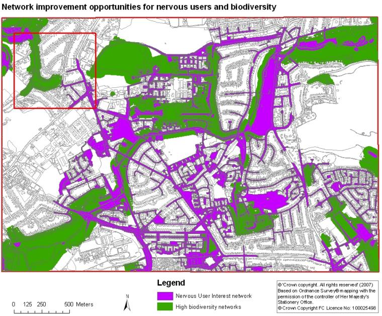
The example (Figure 1) demonstrates how the networks indicating accessibility and use of greenspace can be combined with the networks for high biodiversity greenspace.
The red box highlights an area where, although there is greenspace, not all is accessible for the nervous user and many of those areas that are accessible are not of high biodiversity. The greenspace may be improved by improving the biodiversity quality and accessibility of existing greenspace.
Analysis of the networks in this way can be used to suggest where such areas can be improved to benefit both people and a range of species.
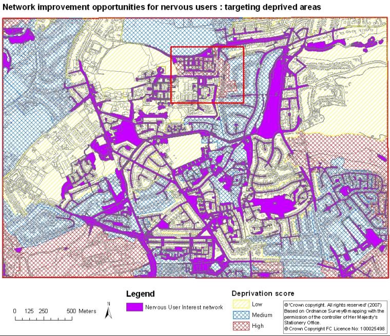
The networks can also be used in conjunction with other datasets to target areas most in need of improvement.

Figure 2 indicates areas where homes do not currently have access to greenspace within low, medium and high levels of deprivation.
The red box indicates an area containing housing within a high level of deprivation which may be a priority for greenspace network improvement.
Application
It is envisaged that multifunctional urban green networks are used to inform planning, including Structure plans and Local Biodiversity Action Plans, forming an integral part of green space planning to improve urban ecosystems and public health.
Funding
The research was funded through SNIFFER by:
For further information contact:
Darren Moseley
Forest Research
Northern Research Station
Roslin
Midlothian EH25 9SY
Tel: 0300 067 5965
Email: darren.moseley@forestry.gsi.gov.uk
