Contact Us

Search Results

Refine Results

Back

Refine Results

Publish Date:

120 Search Results for forest hydrology

  • Publications

    Woodland for Water: Woodland measures for meeting Water Framework Directive objectives

    Lead Author: Tom Nisbet
    This report considers the key issues relating to woodland and the Water Framework Directive (WFD) in England and Wales, but has application to Scotland and Northern Ireland. By Tom Nisbet, Martyn Silgram, Nadeem Shah, Katrina Morrow & Samantha Broadmeadow. Forest Research Monograph: 4ISBN 978-0-85538-830-0 Related pages Forest hydrology Soil sustainability
  • Publications

    Guide to using woodland for sediment control

    Lead Author: Tom Nisbet
    This guide describes the catchment approach that is being developed by a partnership of organisations in Cumbria in northwest England to control sediment inputs to Bassenthwaite Lake. It sets out the steps taken to identify the main sources of sediment and explores how woodland could help to alleviate the problem. By: By Tom Nisbet, Samantha Broadmeadow […]
  • Publications

    A strategic assessment of the afforested peat resource in Wales

    Lead Author: Elena Vanguelova
    This report assesses the distribution of the Welsh peatlands, gives an overview of the likely impacts of peat forming factors and afforested peatland restoration, develops national and field based assessment schemes for the assessment of afforested peatland in Wales viable for restoration, carries out a national GIS assessment identifying potential restoration areas in Wales, tests […]
  • Publications

    Modelling the long-term response of stream water chemistry to atmospheric pollution and forestry practices in Galloway, SW Scotland

    Lead Author: Dr Rachel Helliwell
    Report assessing the long term role of forestry in relation to the acidification and recovery of soil and surface water. It targets some of the most acid impacted head waters in the Galloway region of southwest Scotland, including three sub-catchments in the Black Water of Dee (Dargall Lane, Green Burn and Cuttie Shallow); Cardoon Burn […]
  • Publications

    [Archive] Water use by trees

    Lead Author: T R Nisbet
    This Information Note assesses the factors that influence the water use of trees and considers how conifers and broadleaves are likely to affect water resources in different parts of the UK.
  • Publications

    Forestry and surface water acidification

    Lead Author: T R Nisbet
    Forests and forest management practices can affect surface water acidification in a number of ways. The primary mechanism is the ability of tree canopies to capture more sulphur and nitrogen pollutants from the atmosphere than other types of vegetation. Pollutant scavenging is expected to have peaked in the 1970s when emissions were greatest and led […]
  • Publications

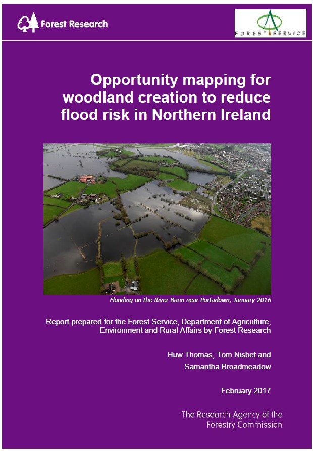
    Opportunity mapping for woodland creation to reduce flood risk in Northern Ireland

    Lead Author: Huw Thomas
    The report provide results, methods and details of the source data used in a mapping project to provide GIS spatial datasets which identify priority areas for woodland creation to benefit flood risk management in Northern Ireland. Maps are also available in an additional document. The results provide a strong basis for developing and refining catchment strategies, initiatives […]
  • Research

    Assessing the Decay and Integrity of Timber Structures used for Natural Flood Management

    Timber structures placed in watercourses and on their floodplains are effective NFM measures, restricting the flow and potentially holding large volumes of water during flood events, helping to reduce downstream flood risk. In an environment where constant wetting and drying occurs, timbers used for NFM measures have a high susceptibility...
  • Research

    Land management in lowland catchments for integrated flood risk reduction

    The LANDWISE project is a collaboration of academics, policymakers and practitioners to investigate the impact of land use and management on flood risk in the Upper Thames catchment. It will quantify through measurement and modelling by how much, where and how the flood risk benefits can be up-scaled from local to river basin level.
  • Research

    Role of natural flood management in flood risk reduction along highways network

    This project investigates the potential to use green infrastructure (including woodland planting) to deliver a sustainable approach to managing flood risk. The strategic road network in England faces a significant increase to disruption and risk of injury due to flooding. Predicted changes in rainfall linked to climate change will require improved...
  • Publications

    Opportunities to use woodland measures for Natural Flood Management in Whinlatter Forest: Scoping Report

    Lead Author: Huw Thomas
    The Forest Design Plan for Whinlatter is currently under review and a new aspirations map has been produced. This includes measures such as habitat creation and proposed extensions to the mountain bike trail network. In addition to these proposals, measures to reduce the community flood risk have been considered; such as soft engineering features (leaky […]
  • Publications

    Opportunities to use woodland measures for Natural Flood Management (NFM) in the Derwent Catchment: Scoping Report

    Lead Author: Huw Thomas
    Forest Research was commissioned by Forestry England to carry out a desk-based GIS exercise to determine the potential opportunities of implementing NFM measures in 4 forest areas in the Derwent Catchment. The study focused on the Parkwood Isel, Howgill and Messengermire, Setmurthy and Matterdale forest areas. A desk-based GIS exercise was carried out by Forest Research […]