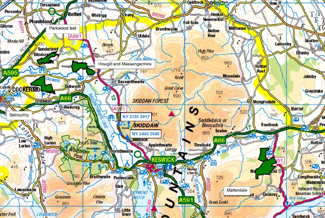
Forest Research was commissioned by Forestry England to carry out a desk-based GIS exercise to determine the potential opportunities of implementing NFM measures in 4 forest areas in the Derwent Catchment. The study focused on the Parkwood Isel, Howgill and Messengermire, Setmurthy and Matterdale forest areas.
A desk-based GIS exercise was carried out by Forest Research for Forestry England in order to identify and target the most effective locations and assess the potential scale of Natural Flood Management opportunities in six forest areas (some 1,259ha of forest) within the Derwent Water catchment.
Opportunities were found in all six areas. Matterdale proved to have the most potential over a wide range of NFM measures, including new woodland planting areas to help reduce runoff, with a significant number of LWS building potential and runoff attenuation within the forest area. Isel and Howgill & Messengermire also have the potential for a significant number of LWS features as well as opportunities for floodplain reconnection.
Implementation of NFM measures in the forest estate will help support community flood risk alleviation, incorporating planting in appropriate areas to help reduce rapid runoff and alleviate flood flows in the catchment, as well as using soft engineering features such as leaky dams in the forest estate to store more water during periods of high flows.