The Forest Design Plan for Whinlatter is currently under review and a new aspirations map has been produced. This includes measures such as habitat creation and proposed extensions to the mountain bike trail network. In addition to these proposals, measures to reduce the community flood risk have been considered; such as soft engineering features (leaky dams) in the forest estate to store more water during periods of high flows.
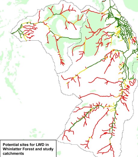
In order to target the most effective locations and assess the potential scale of the NFM opportunities in the forest, Forest Research conducted a desk-based GIS assessment for the Whit Beck and Newlands Beck catchments.
Over 7.8 km of watercourse in the forest was identified as being suitable (<2° average stream gradient) for the construction of LWD to hold back and slow the passage of flood water. An estimated 262 LWD features could be built along these reaches, potentially storing 196,200 m3 of water.
Runoff Attenuation Features (RAFs) could contribute significant additional flood water storage within the forest.
It is recommended that the results and maps of this exercise be used to ground-truth the identified sites for NFM measures to estimate their potential contribution to reducing downstream flood risk.