Exploring natural solutions to reduce traffic incidents caused by flooding
8 Oct 2019
A recent project has investigated the potential of using Natural Flood Management (NFM) to reduce flooding incidents on the strategic road network.
In the past few years there has been an increase in the number and intensity of rainfall events, leading to significant flooding of the highways network across the country, possibly linked to climate change. This has prompted Highways England to investigate the vulnerability of the strategic road network (SRN) to future flooding, and in particular to identify, assess and recommend measures for managing the predicted increase in flood risk due to climate change.
Our researchers worked with partners Treeconomics, Evans Associates and Kier to assess three flooding ‘hotspots’ in southwest England.
First, a detailed site survey was carried out to pinpoint areas of land contributing runoff to each hotspot, then a hydrological model was applied to the individual catchments.
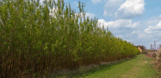
A ‘time of flow concentration’ function identified fast response zones and pathways. A number of potential NFM measures, including woodland creation, were modelled in order to assess and rank options for reducing runoff volumes across individual catchment areas.
The target flow reduction for removing hotspot status in some catchments was found to be delivered by a combination of agricultural land management measures, such as soil aeration treatments on grassland, improved tillage practices on arable land and targeted tree planting on the highest runoff-producing areas.
The work identified a preferred option for each site, which will be further developed with landowners and managers. If successful, the approach could be rolled out to reduce flooding incidents across the wider highways network.
The installation of new green infrastructure (such as woodland planting) and improved land management practices could help to deliver a more sustainable approach to managing future flood risk.
This webinar explores the latest UK and international research on short rotation forestry, highlighting its potential to deliver sustainable biomass, carbon sequestration, and emissions reductions while supporting a low‑emissions future.
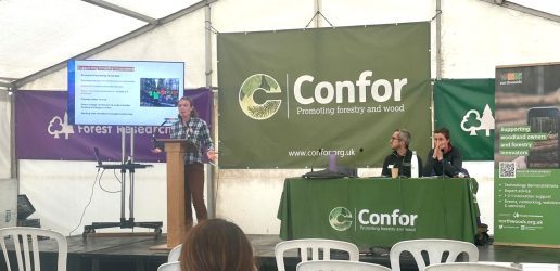
At APF 26, we’re launching Talking Forestry, a new free event series of short talks and panel discussions in the Confor tent.
Carbon experts Robert Matthews and Carly Whittaker discuss how forest management affects the carbon balance in a new featured article for the Royal Forestry Society’s Quarterly Journal of Forestry.
This webinar explores the latest UK and international research on short rotation forestry, highlighting its potential to deliver sustainable biomass, carbon sequestration, and emissions reductions while supporting a low‑emissions future.
At APF 26, we’re launching Talking Forestry, a new free event series of short talks and panel discussions in the Confor tent.
Carbon experts Robert Matthews and Carly Whittaker discuss how forest management affects the carbon balance in a new featured article for the Royal Forestry Society’s Quarterly Journal of Forestry.