From 1987 until 2006 the Forestry Commission monitored annual changes in the condition of Britain’s forest trees by assessing the status of five forest species via a network of permanent monitoring plots distributed throughout the country. The species assessed were: Sitka spruce (Picea sitchensis), Norway spruce (P. abies), Scots pine (Pinus sylvestris), oak (Quercus spp.) and beech (Fagus sylvatica). The results (by year and by species) for the period 2000–2006 are presented here.
Methodology
The plots consisted of 24 trees located in four sub-plots of six trees and, depending upon the species assessed, between 29 and 33 features indicative of condition were scored for each tree. Evaluations of the incidence of flowering and fruiting, or the incidence of damage by insects or fungi were made, but the feature of the greatest interest was an assessment of crown density. This is an estimate of the degree of opacity of the crown, which is used as an index of tree condition. Until 1993, the basis for comparison used in the surveys conducted in the United Kingdom was an ‘ideal’ tree carrying the maximum possible amount of foliage. However, in similar surveys conducted in most other European countries, comparisons are most commonly made with reference to a tree with full foliage under local conditions (the ‘local tree’ method). Usually this method involves selecting the tree with the greatest amount of foliage in the general vicinity of a survey plot to serve as a standard against which the plot trees are assessed. The same local tree is generally retained from year to year but it may be replaced by another tree in the event that its condition deteriorates. In order to harmonise with results obtained in other countries, crown density estimates in the United Kingdom have been made using the local tree method since 1993. However, to maintain the existing time series of crown density figures, all plot trees have also been assessed using the previous idealised standard.
Reductions in crown density are estimated in 5% classes by reference either to a standard set of photographs of ‘ideal’ trees or to ‘instant’ photographs of individual local reference trees. Data are collected on hand-held computers and are checked for consistency and for departures from expected values both in the field and before analysis. Except where otherwise stated, the crown density results presented here are those obtained by comparison with an ‘ideal’ standard.
To check the consistency of the crown density scores made by teams of assessors involved in the survey, a proportion of the plots are re-assessed by experienced supervisors. The assessments of the supervisors are also checked against each other in a separate exercise.
References and useful sources of information
References and supporting publications
Last updated: 13th March 2018
Beech
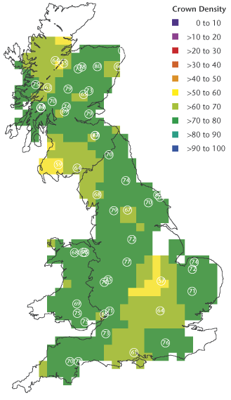
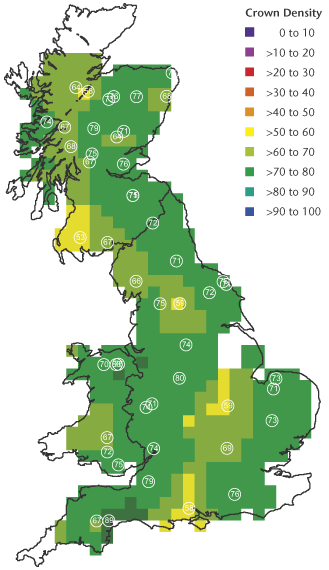
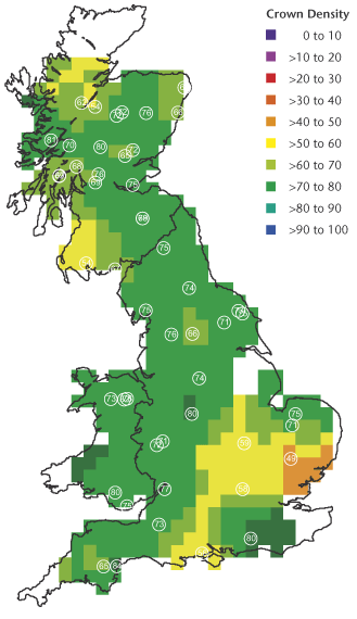
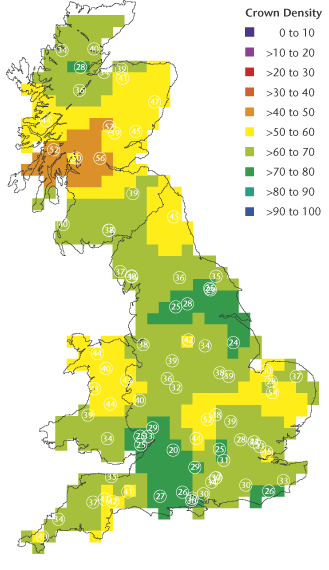
Geographical variation in crown density for oak between 2000 and 2005. White circles show the locations of plots, and figures within the circles are mean crown densities (%). Some plots are too close to be distinguished individually. The value assigned to each 20 km square was calculated from weighted averages (weight is proportional to 1/d², where d = distance) for all plots within 70 km of the 20 km square centre.
Beech 2000
Beech 2001
Beech 2002
Beech 2003
Beech 2004
Beech 2005
Beech 2006
Norway spruce
Geographical variation in crown density for oak between 2000 and 2005. White circles show the locations of plots, and figures within the circles are mean crown densities (%). Some plots are too close to be distinguished individually. The value assigned to each 20 km square was calculated from weighted averages (weight is proportional to 1/d², where d = distance) for all plots within 70 km of the 20 km square centre.
Norway Spruce 2000
Norway Spruce 2001
Norway Spruce 2002
Norway Spruce 2003
Norway Spruce 2004
Norway Spruce 2005
Norway Spruce 2006
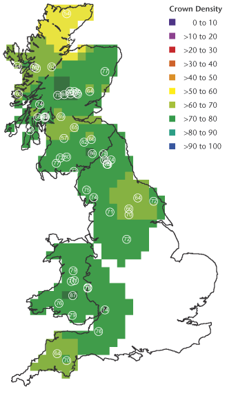
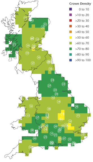
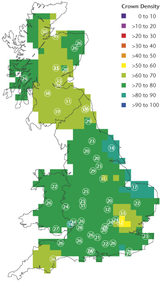
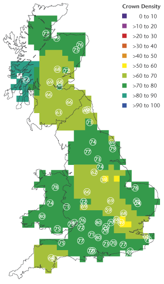
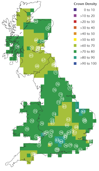
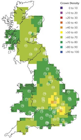
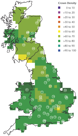
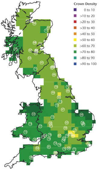
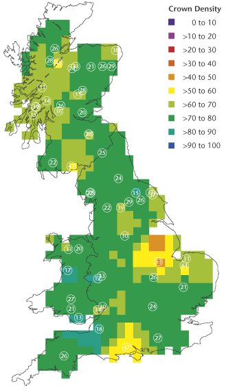
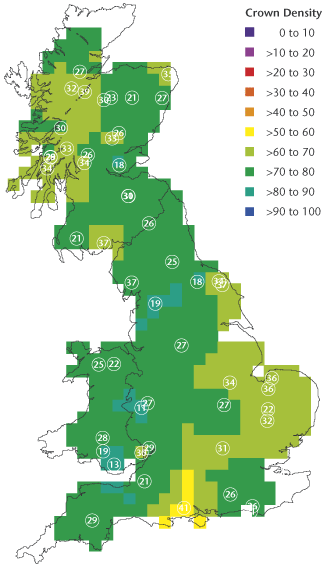
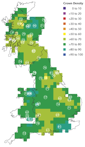
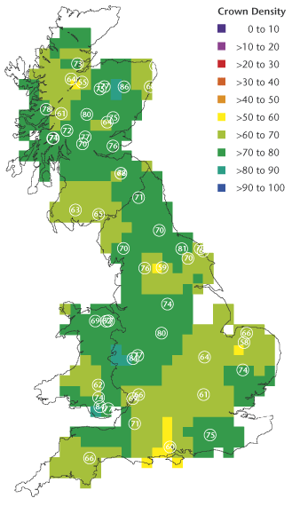
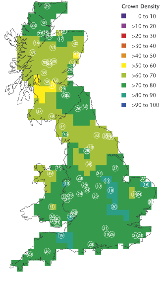
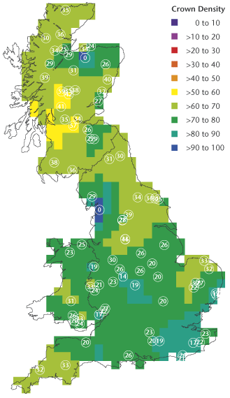
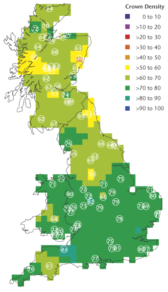
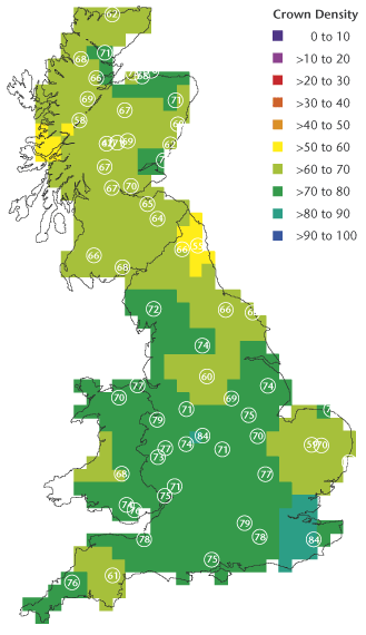
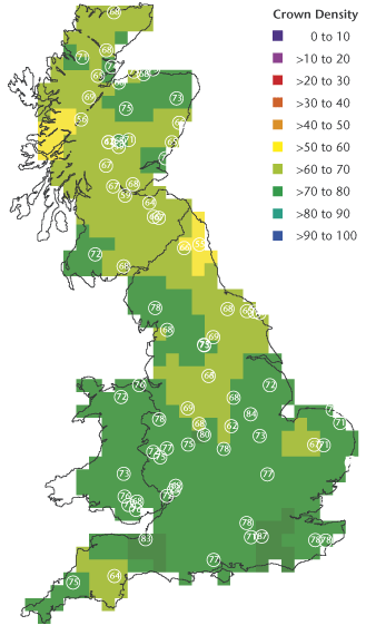
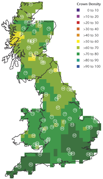
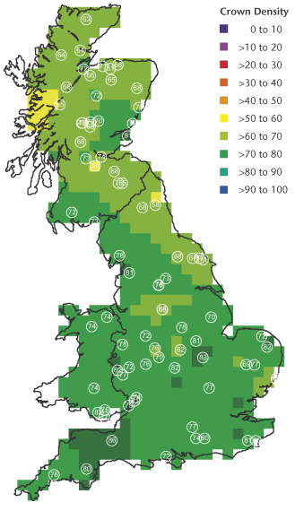
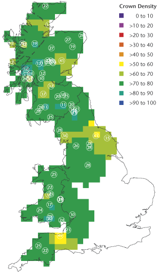
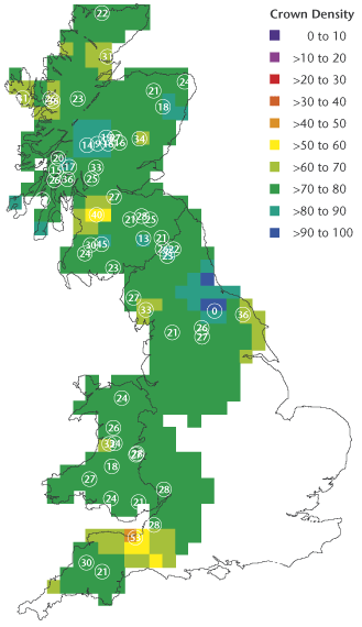
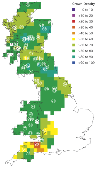
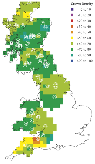
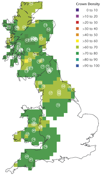
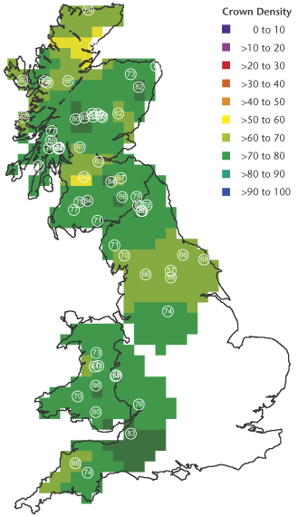
Results by species – Oak
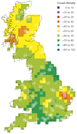
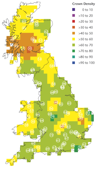
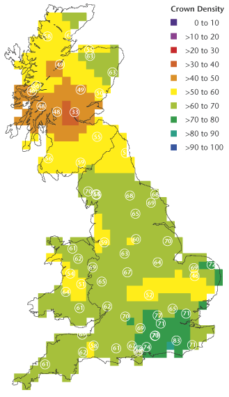
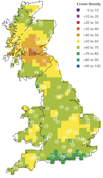
Geographical variation in crown density for oak between 2000 and 2005. White circles show the locations of plots, and figures within the circles are mean crown densities (%). Some plots are too close to be distinguished individually. The value assigned to each 20 km square was calculated from weighted averages (weight is proportional to 1/d², where d = distance) for all plots within 70 km of the 20 km square centre.
Oak 2000
Oak 2001
Oak 2002
Oak 2003
Oak 2004
Oak 2005
Oak 2006
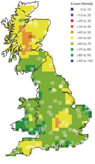
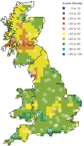
Scots pine
Geographical variation in crown density for oak between 2000 and 2005. White circles show the locations of plots, and figures within the circles are mean crown densities (%). Some plots are too close to be distinguished individually. The value assigned to each 20 km square was calculated from weighted averages (weight is proportional to 1/d², where d = distance) for all plots within 70 km of the 20 km square centre.
Scots pine 2000
Scots pine 2001
Scots pine 2002
Scots pine 2003
Scots pine 2004
Scots pine 2005
Scots pine 2006
Sitka spruce
Geographical variation in crown density for oak between 2000 and 2005. White circles show the locations of plots, and figures within the circles are mean crown densities (%). Some plots are too close to be distinguished individually. The value assigned to each 20 km square was calculated from weighted averages (weight is proportional to 1/d², where d = distance) for all plots within 70 km of the 20 km square centre.
Sitka spruce 2000
Sitka spruce 2001
Sitka spruce 2002
Sitka spruce 2003
Sitka spruce 2004
Sitka spruce 2005
Sitka spruce 2006