Summary
About the project
Slowing the Flow at Pickering is exploring a new approach to flood management. It is about working with nature to try and store more water in the landscape and slow its passage downstream. Whilst this will not prevent all flooding, it is expected to reduce the frequency of future floods in Pickering, as well as deliver a range of other benefits to the local environment and community.
Key highlights from the project are:
- A strong partnership has delivered a more sustainable approach to managing flood risk, which has reduced the risk of flooding in the town of Pickering from a 25% chance in any year to a less than 4% chance.
- Flood alleviation has been achieved by working with natural processes, including building a large flood storage area, placing 167 ‘leaky’ woody dams and 187 heather bale dams within streams, building two timber bunds, planting 44 ha of woodland and improving farmland, moorland and woodland management.
- The local community and partners have embraced the concept of working with natural processes and believe this new approach to flood risk management is already making a difference.
Pickering was much in the news over Christmas 2015 with various reports about how well or not the Slowing the Flow project measures had protected the town from flooding. Some claimed that they had prevented major flooding as experienced in York, while others suggested that the measures had not been properly tested because whilst rainfall was significant it was less than elsewhere. This led to a discussion about the merits of the new approach to flood management being evaluated at Pickering.
In an effort to resolve the issue, a study was made of the rainfall that was received at Pickering over Christmas Day and Boxing Day, and an assessment made of the resulting river flows. This work concludes with a relatively high degree of certainty that the Slowing the Flow project measures prevented flooding that would otherwise have occurred to a few residential properties and the museum on the Beck Isle area of the town. It is estimated that the measures reduced the flood peak by around 15-20%, with around half of the reduction due to the upstream land management measures and half due to the main flood storage area. A briefing note reporting the results is available here. Slowing the Flow Partnership Briefing: Boxing Day 2015 Flood Event
For further information contact
Forest Research
Related information
Click on map or link to view enlarged version of map. Enlarged maps are A3 landscape at 96dpi, and open in a new window.
Pickering Beck and River Seven catchments in North Yorkshire showing the Forestry Commission landholding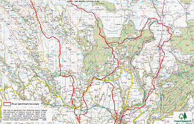
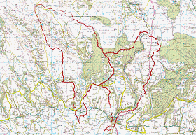
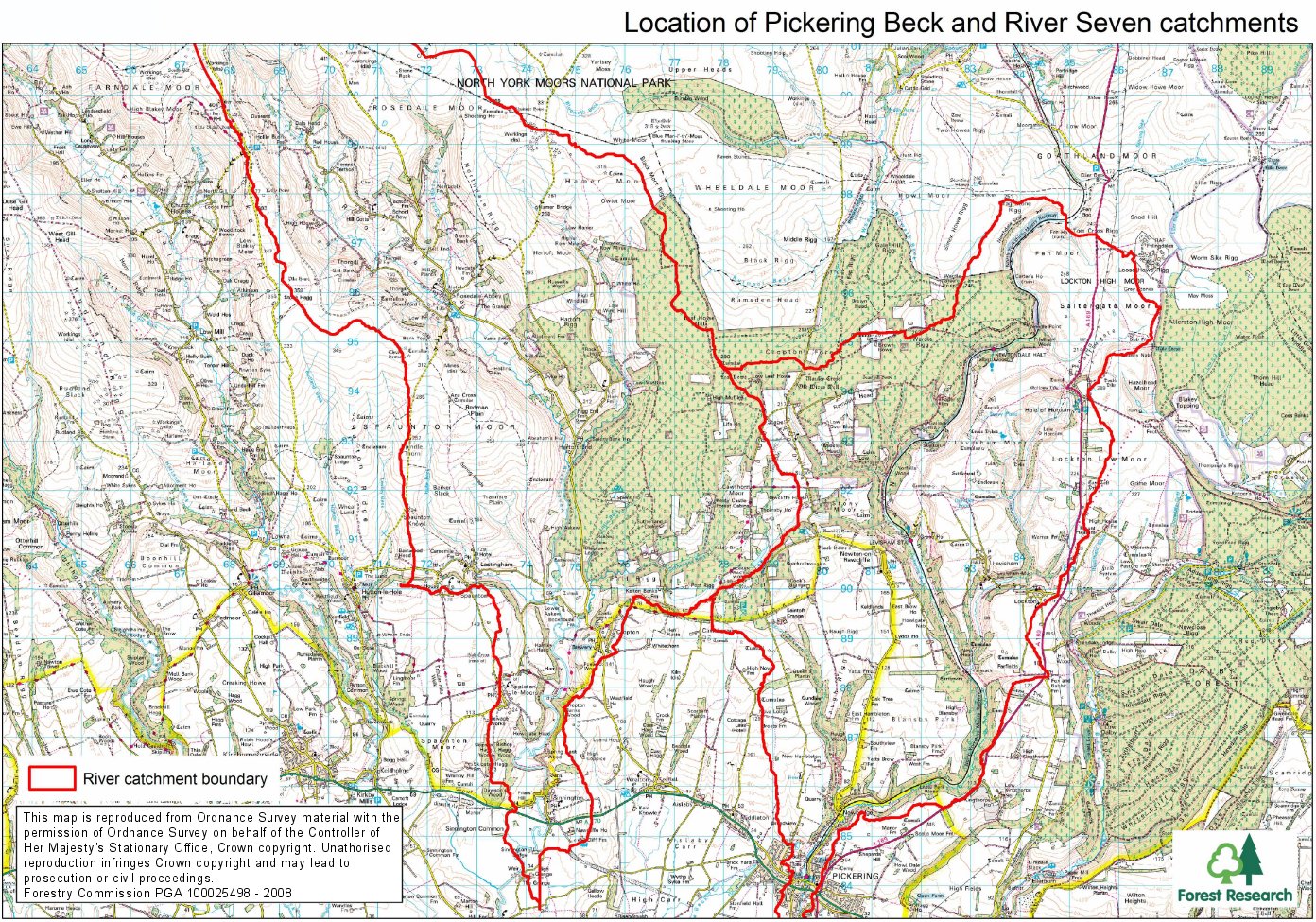
Location of Pickering Beck and River Seven catchments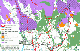
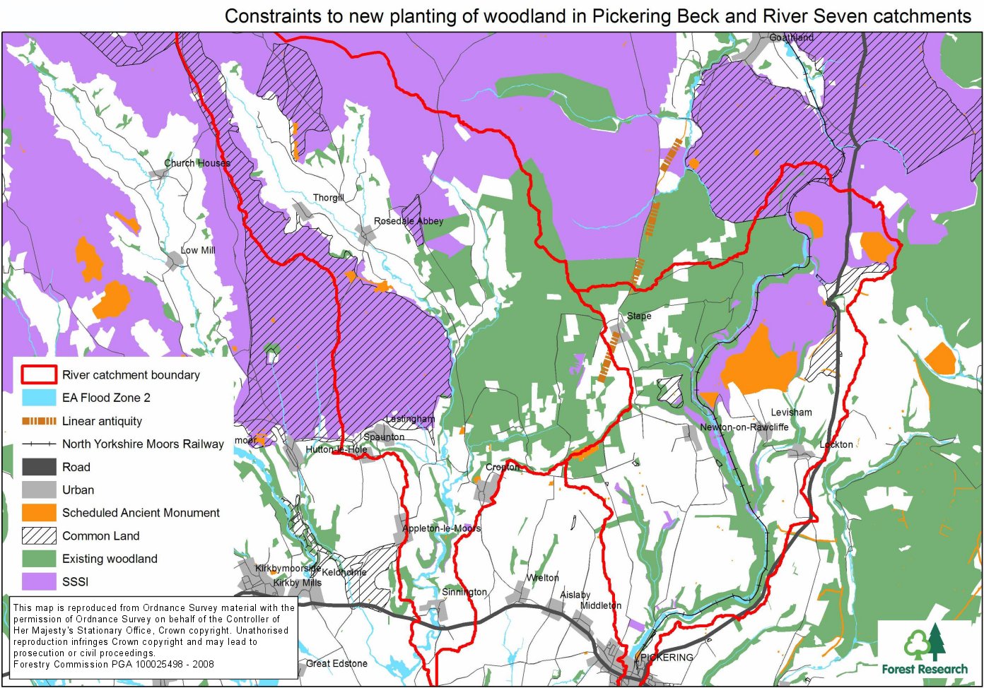
Constraints to new planting of woodland in Pickering Beck and River Seven catchments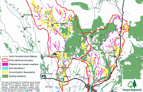
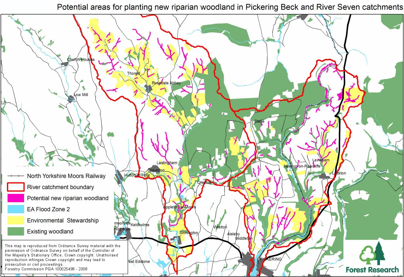
Potential areas for planting new riparian woodland in Pickering Beck and River Seven catchments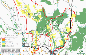
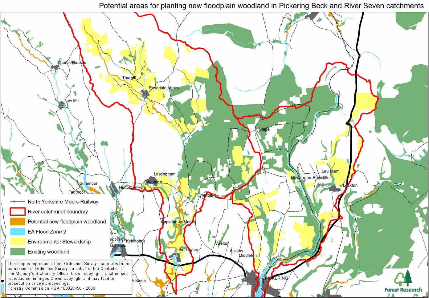
Potential areas for planting new floodplain woodland in Pickering Beck and River Seven catchments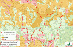
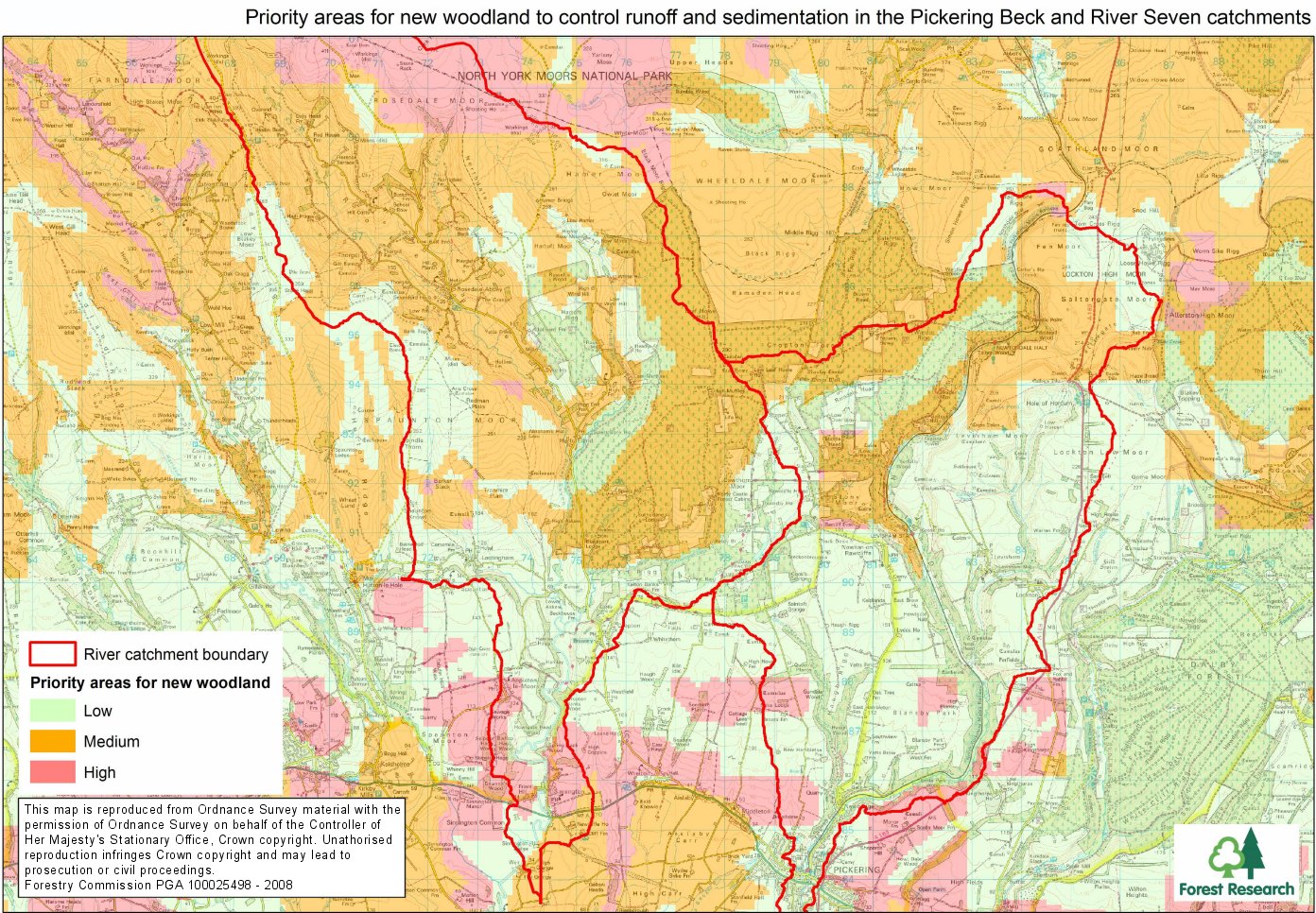
Priority areas for new woodland to control runoff and sedimentation in Pickering Beck and River Seven catchments

Other photos and maps:
General Content
What’s of interest
Final report on the results of Phase 1 of the project April 2011
Final report on the results of Phase 2 of the project May 2015