New citizen science app launched
17 Dec 2021
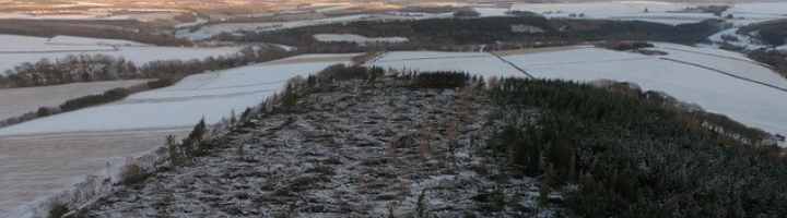
A new citizen science application has been launched to identify potential areas of windblown conifer trees following the devastating impact of Storm Arwen.
Forest Research is working with Confor, the Forestry Commission and Scottish Forestry to fully assess the impact the storm has had on the nation’s forests and woodlands.
Earth observation data has been used by Forest Research to identify potential areas of windblown conifer trees across England and Scotland using a novel machine learning algorithm. The project partners are today launching a citizen science application for foresters, land-owners land managers to view, validate and add to this data. This will help us understand what is required to clear up the damaged trees and help improve future versions of the data algorithm to aid in the response to future storm events.
We invite submissions via the dedicated citizen science portal or an offline capable mobile application in the field, with a closing date of 23rd January 2022.
Only professionals who have considered the risks involved with windblow should attempt to map it in the field.
Please visit the website: https://windblow-assessment-forestergis.hub.arcgis.com/
Photo credit: Hamish Oliphant
Carbon experts Robert Matthews and Carly Whittaker discuss how forest management affects the carbon balance in a new featured article for the Royal Forestry Society’s Quarterly Journal of Forestry.
On Wednesday 17 June, Forest Research was admitted to the European National Forest Inventory Network (ENFIN).