 Archaeological information is routinely sought as part of the Woodland Grant Scheme (WGS) consultation procedures. This usually involves a local authority archaeologist who will have access to a register of known sites (the Sites and Monuments Record). When important remains are identified, the land on which they are located is typically excluded from the scheme or incorporated into planned open spaces.
However, the location of some sites within the surrounding landscape may suggest a favourable place in which buried archaeological evidence may occur. If such an area is also a wetland site, any archaeological evidence may be well-preserved. When no above-ground archaeological indicators exist, the site must be evaluated on its archaeological potential. A risk assessment of potential damage caused by a change in land use is therefore required, so that informed decisions can be made.
There are several methods of archaeological investigation available to help determine a site’s potential, but these can have varied results and cost implications. Examples include:
- Desk based assessments
Examination of old maps and historic records.; - Walk-over/landscape assessment
Asite visit to identify and interpret both natural and anthropogenic landscape features. - Remote sensing techniques
Ranging from examination of aerial photographs and other airborne surveys to ground based geophysical methods. - Trial excavations
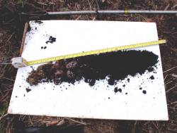
Usually only covering a very small percentage of the area of interest
No one single method is guaranteed to find all of the archaeological evidence to be found on a site and some are more suitable to than others either under certain environmental conditions, or to find particular types of remains.
An example of site assessment on a site believed to be of archaeological potential(PDF-1180K) in the historic environment section in the 2002-2003 Forest Research Annual Report.