An integrated spatial platform for forest and land management.
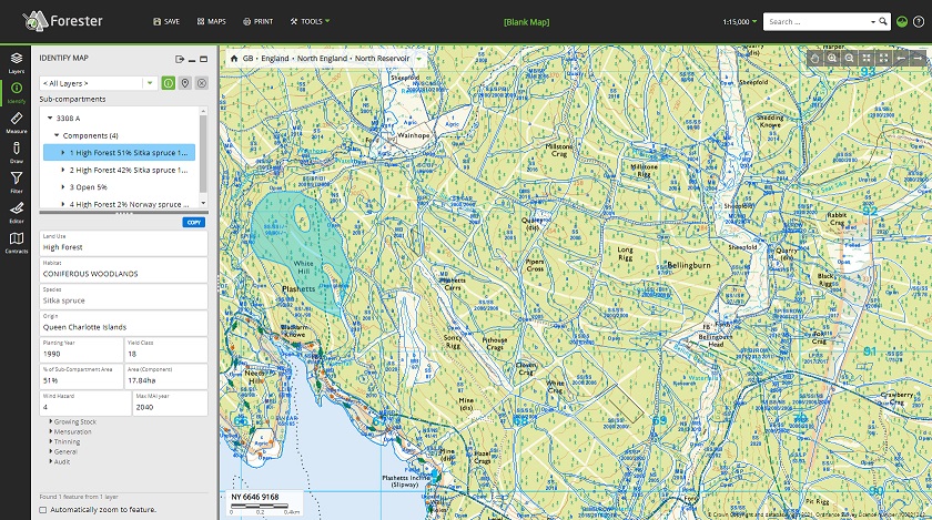
Forester is a highly configurable, enterprise, cloud based, integrated web and mobile GIS platform. Forester enables any organisation or estate to acquire, use, maintain and share the data needed to inform decision-making – whether on the ground or in the office.
Forester was originally developed for the Forestry Commission and is now used by a range of government and private sector organisations. Forester can help you deliver your economic, environmental and social land management objectives in a transparent and sustainable way. The single asset management platform increases efficiency and reduces risk by ensuring that all staff can easily access the right information at the right time.
Forester can help you to…
- Be clear and confident about the location and nature of your assets
- Plan for the future by adding value to your inventory and other data
- Meet your legal obligations for health and safety and requirements under environmental legislation
- Demonstrate the sustainability of your forest and woodland management activities by customised reporting, dashboards and standardised mapping
Field Data Collection
At Forest Research we are committed to developing our understanding of how to support foresters and arboriculturists in the challenges they face so they can do their jobs more effectively. A key element in this is providing a platform that helps foresters to turn data collected in the field into information via maps to assist the forest management decision-making process. Forester is built upon the Esri ArcGIS Enterprise platform, which enables Forest Research to seamlessly augment out of the box mobile applications such as ArcGIS Survey123 and ArcGIS Field Maps, as well as web dashboards, as part of the Forester experience.
We have identified four common themes facing organisations when collecting forest and tree-related data:
Consistency
Data collection that minimises post-capture data correction and underlies the principle that data collected once can be used many times.
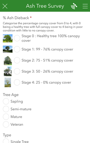
We have a demonstration survey where you can see this in action for yourselves. Click on the link below to see an example Ash Tree survey, which can be filled in online or via a mobile application.
Link to example Ash Tree Survey
Compliance
Ensuring key legal/best practice requirements are met.
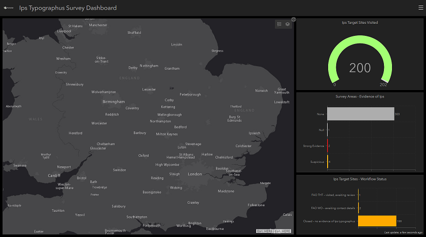
To compliment the example Ash Tree Survey linked to in the above section, you can monitor and report on results as they come in. Click on the link below to see example surveys completed using the Ash Tree Survey form or mobile application.
Link to an example Ash tree survey dashboard.
Efficiency
The effective and targeted use of resources during the collection of data and for those that require access to the data – regardless of where they are based.
Video of Forester in action at Forester and Land Scotland.
Collaboration
Summarising, sharing and consuming the data with colleagues, external stakeholders, partners and the public.