Summary
Monitoring at this plot is currently suspended.
Current and planned research projects related to this plot
- Ectomycorrhizal fungal communities
- Sampling soil in forests: accounting for spatial variation
- Soil mineral weathering rates
- Further development and implementation of an EU-level forest monitoring system (FutMon)
Measurements
A summary of the variables monitored at this site can be found here.
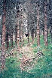
Description
| Date of installation | 14/06/1995 |
|---|---|
| Planting year | 1965 |
| Main tree species | Scots Pine |
| Other tree species present in plot | None |
| Forest type | Plantation |
| Sylvicultural system | |
| Tree density | 1909 trees/ha |
| Biomass/volume | 243 m3/ha (2005) |
| Basal area | 47.2 m2/ha (2005) |
| Local Yield Class | 9 |
| Plot dimensions | 0.305 ha |
| Altitude | 470 m |
| Mean slope | 25-30 m |
| Geology | Quaternary sands and gravel |
| Topography | Concave at bottom to convex at top, small platforms and shallow wet gullies. |
| Aspect | West |
| Rainfall | 1500 mm |
| Provisional soil type (FAO 1988) | Gleyic podzol |
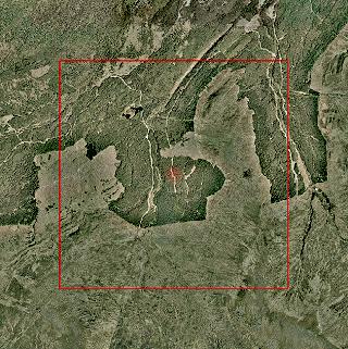
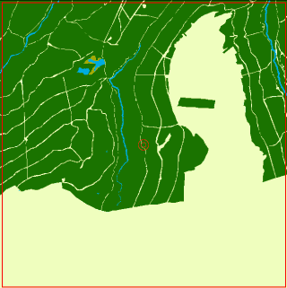
Surrounding habitat