Summary
THIS PLOT IS NOW CLOSED. No monitoring is currently carried out at this plot.
Research projects related to this plot
- Dissolved organic carbon in soil solution
- Soil mineral weathering rates
Measurements
A summary of the variables monitored at this site can be found here.
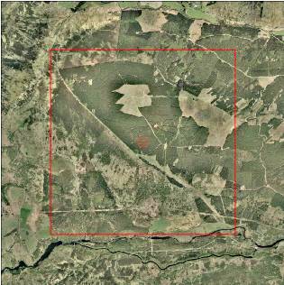
Description
| Date of installation | 19/06/1995 |
|---|---|
| Planting year | 1969 |
| Felling year | 2015 |
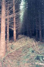
| Main tree species | Sitka Spruce |
| Other tree species present in plot | |
| Forest type | |
| Sylvicultural system | Plantation. BEAR code 33 |
| Tree density | |
| Biomass/volume | 779 m3/ha (2005) |
| Basal area | 92.4 m2/ha (2005) |
| Local Yield Class | 17 |
| Plot dimensions | 0.3081 ha |
| Altitude | 400 m |
| Mean slope | 8 % |
| Geology | |
| Topography | Upland |
| Aspect | South West |
| Rainfall | 1500 mm |
| Provisional soil type (FAO 1988) | Ferric podzol |
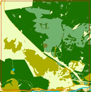
Surrounding habitat