Summary
Monitoring at this plot is currently suspended.
Current and planned research projects related to this plot
- Dissolved organic carbon in soil solution
- Ectomycorrhizal fungal communities
- Soil mineral weathering rates
- Further development and implementation of an EU-level forest monitoring system (FutMon)
- The role of atmospheric deposition in affecting spatial and temporal changes in forest water-use efficiency and nitrogen availability across Britain
Measurements
A summary of the variables monitored at this site can be found here.
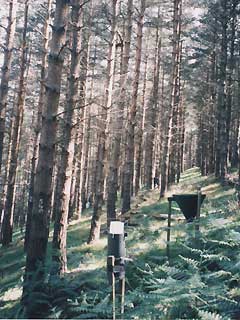
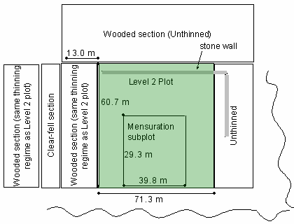
Description
| Date of installation | 01/02/1995 |
|---|---|
| Planting year | 1952 |
| Main tree species | Scots Pine |
| Other tree species present in plot | None |
| Forest type | Plantation |
| Sylvicultural system | |
| Tree density | 1125 trees/ha (2005) |
| Biomass/volume | 415 m3/ha (2005) |
| Basal area | 63.6 m2/ha (2005) |
| Local Yield Class | 9 |
| Plot dimensions | 0.3801 ha |
| Altitude | 260-270 m |
| Mean slope | 22.5 % |
| Geology | |
| Topography | Steeply dissected valley side |
| Aspect | North west |
| Rainfall | 964 mm |
| Provisional soil type (FAO 1988) | Cambic podzol |
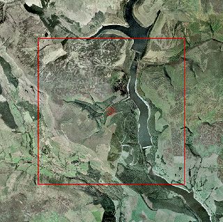
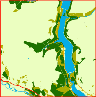
Surrounding habitat