Summary
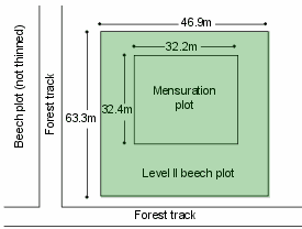
Measurements
A summary of the variables monitored at this site can be found here.
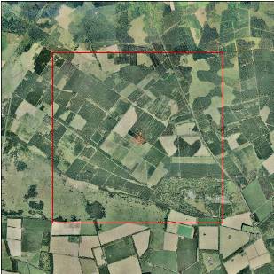
Description
| Date of installation | 08/08/2002 |
|---|---|
| Planting year | 1955 |
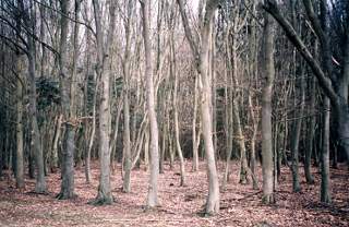
| Main tree species | Beech |
| Other tree species present in plot | |
| Forest type | Plantation |
| Sylvicultural system | |
| Tree density | |
| Biomass/volume | 400 m3/ha (2005) |
| Basal area | 50 m2/ha (2005) |
| Local Yield Class | 8 |
| Plot dimensions | 0.3 ha |
| Altitude | 50 m |
| Mean slope | 2 % |
| Geology | Cretaceous |
| Topography | Within the plot the ground is level |
| Aspect | South West |
| Rainfall | 630 mm |
| Provisional soil type (FAO 1988) |