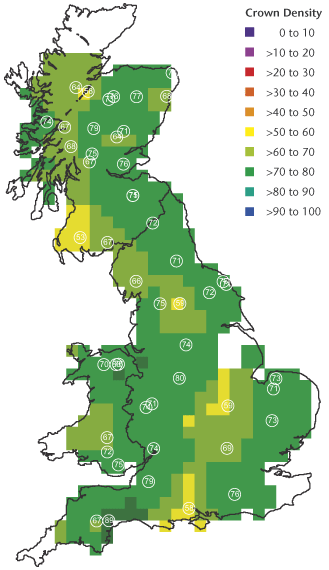
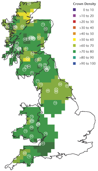
Figure 2: Geographical variation in crown density for five species in 2005. White circles show the locations of plots, and figures within the circles are mean crown densities (%). Some plots are too close to be distinguished individually. The value assigned to each 20 km square was calculated from weighted averages (weight proportional to 1/d2, where d = distance) for all plots within 70 km of the 20 km square centre.
Oak 2005
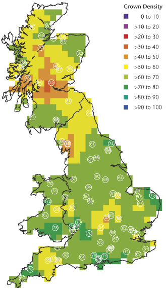
Scots pine 2005
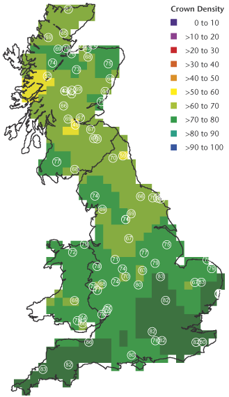
Beech 2005
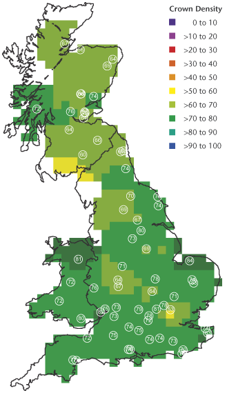
Sitka spruce 2005
Norway Spruce 2005